El Paso, TX
31.812083, -106.542667
Lightweight Vehicle Surveillance System (LVSS)
Dugan Meyer, May 2024

A type of Mobile Surveillance Capability (MSC) system, the Lightweight Vehicle Surveillance System (LVSS), also referred to as the Mobile Surveillance Capability Lite (MSC-Lite), is another type of truck-mounted, mobile surveillance tower. Radar technology and electro-optical/infrared cameras sit atop an articulating, rapidly deployable tower apparatus, and the operator can view the sensor feeds on monitors within the vehicle’s cab. These units are often operated by National Guard or other military personnel.

This LVSS is positioned on a ridgeline beyond the farthest parking lot of a shopping mall on El Paso’s northwest side. From its perch, it looks out over Interstate 10, past car dealerships and a casino onto Sunland Park, New Mexico, a residential area at the foot of Mount Cristo Rey, one of the most actively surveilled zones in the region. A segment of the border drawn over this mountain is an increasingly rare, unfenced section, and the vantage points provided by the altitude has made this a common entry spot for those trying to evade the dense assemblage of security infrastructure designed to deter and capture them. A recent report from the group No More Deaths has documented the surprising number of deaths that occur here amid houses and businesses. Many take only a small amount of water with them as they attempt the treacherous descent. When they are met by border police waiting below—guided by surveillance assets including this LVSS—many do not have the strength to make it back.

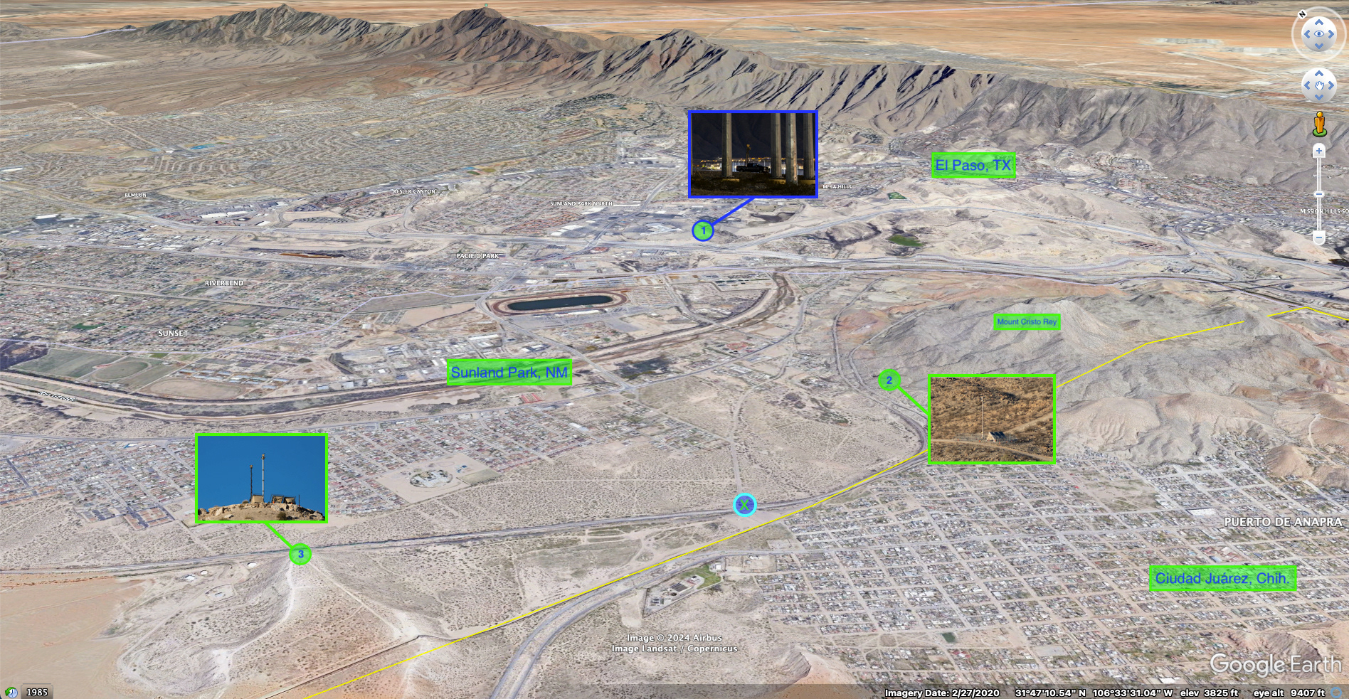
A Google Earth image of the Sunland Park, New Mexico / El Paso, Texas / Ciudad Juárez, Chihuahua area. Site #1 is the location of the MSC/LVSS pictured in Photograph 27 that headlines this page. Site #2 is the location of a "Sentry" Autonomous Surveillance Tower (AST) on the western face of Mount Cristo Rey. Site #3 is the location of another "Sentry" Autonomous Surveillance Tower (AST); a mobile surveillance tower—like the Mobile Vehicle Surveillance System (MVSS) / “Scope Truck” in the images on this page—is often also deployed here alongside this AST. The blue X icon is the approximate location from which I took many of the photos included below.

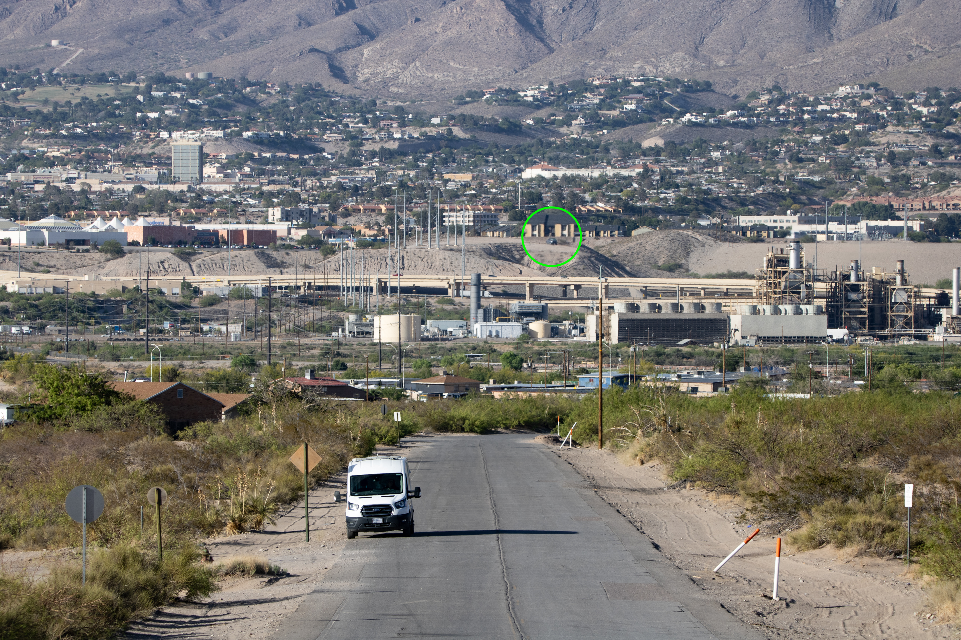
The site of the MSC/LVSS mobile surveillance tower in Photograph 27 (circled in green and slightly magnified) and labeled as Site #1 in the Google Earth image above, photographed on another day from about 2.4 mi / 3.9 km to the southwest at the spot labeled with the blue X above. I have observed both LVSS and MVSS mobile surveillance towers deployed at the site, and cannot say with certainty which type is pictured in this image. In the foreground is a U.S. Border Patrol van.

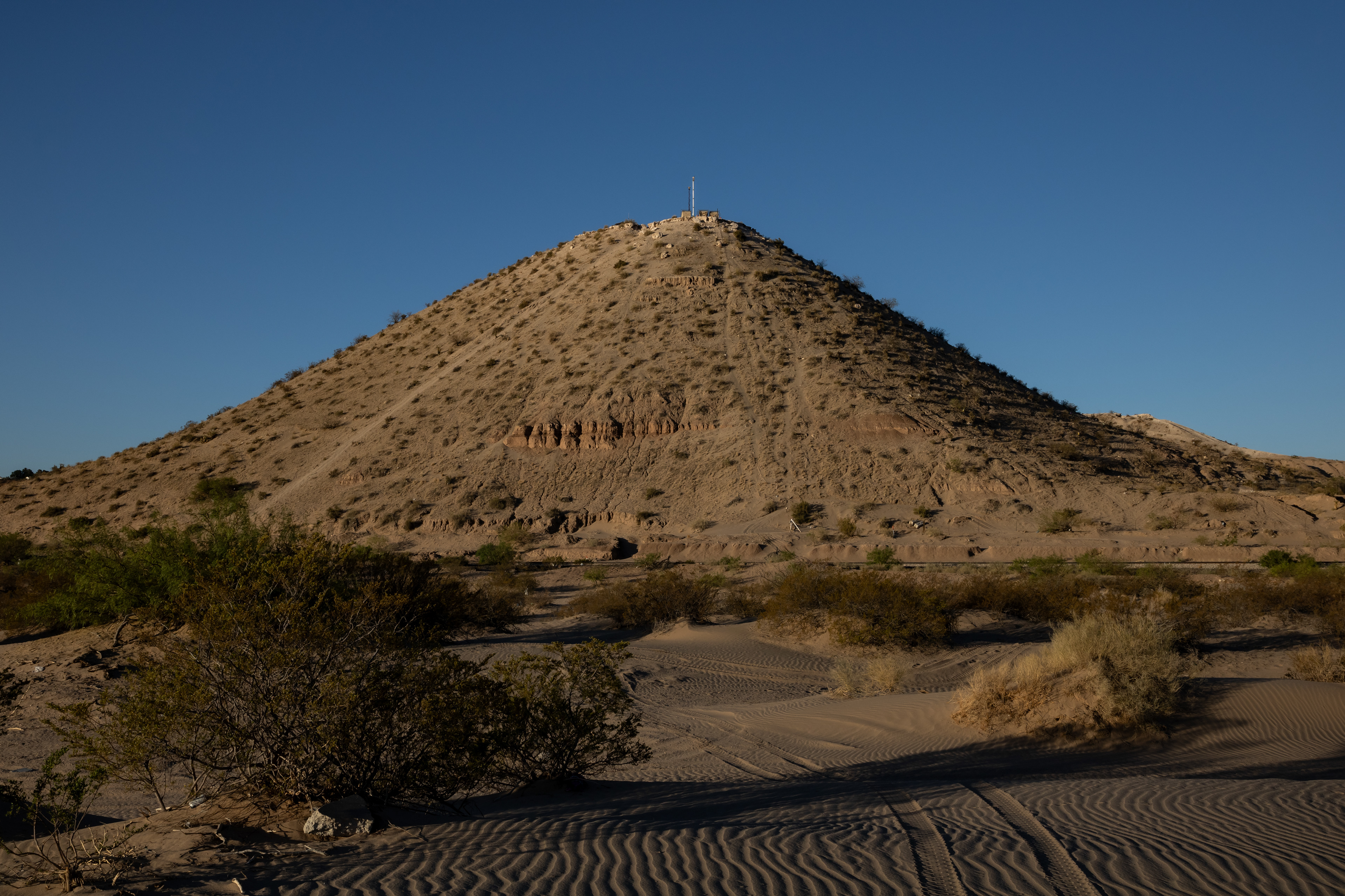
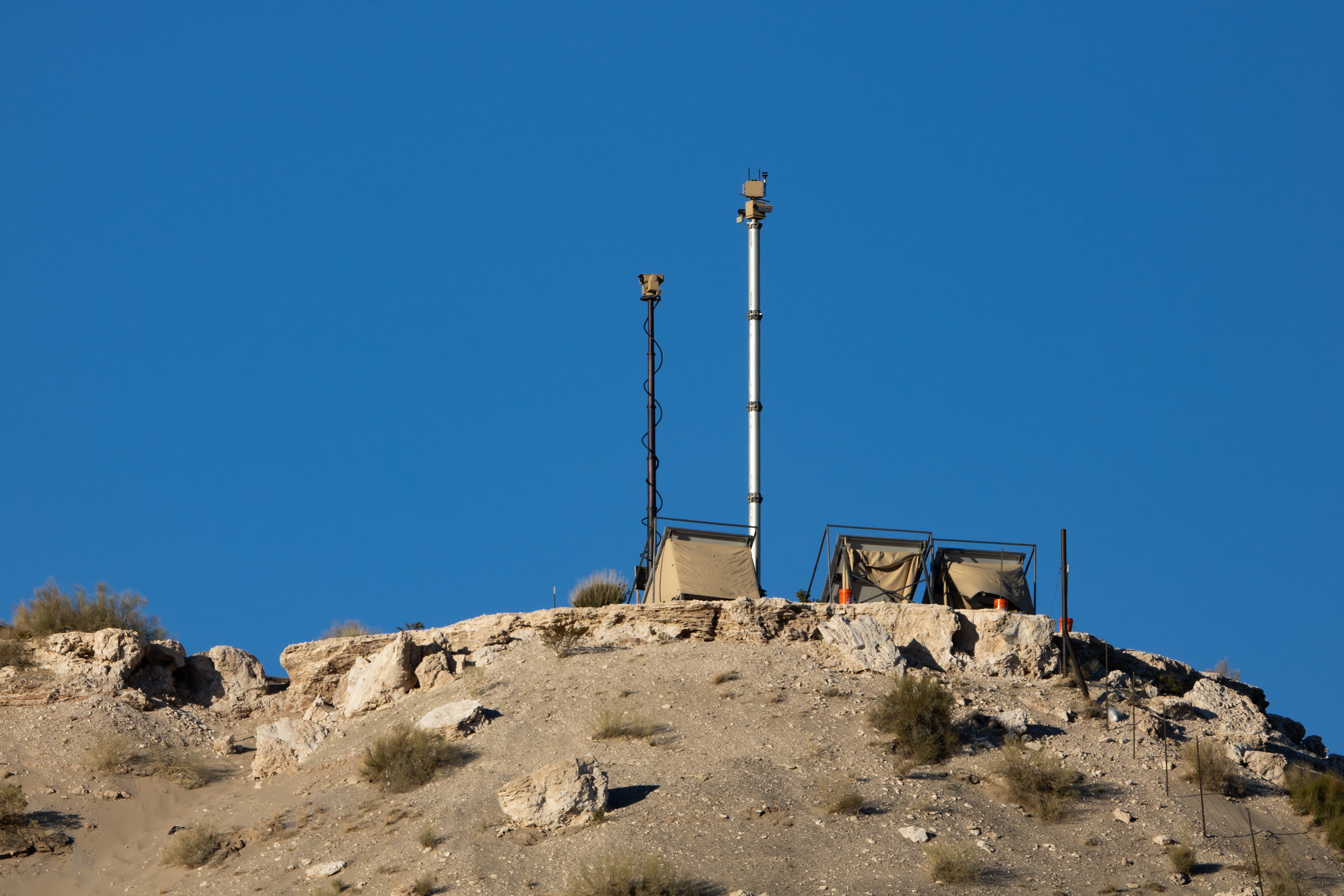
The "Sentry" Autonomous Surveillance Tower (AST) located at Site #2 in the Google Earth image above—on the northwest face of Mount Cristo Rey at 31.788944, -106.556083—​​​​​​​and a U.S. Border Patrol truck.

Above three images: The "Sentry" Autonomous Surveillance Tower (AST) and Mobile Vehicle Surveillance System (MVSS) / “Scope Truck” located at Site #3 (31.78961851, -106.5828784) in the Google Earth image above.
Autonomous Surveillance Towers (ASTs) and mobile surveillance units like the MVSS and LVSS are only part of the surveillance infrastructure deployed here. Agents from multiple federal and state police organizations, as well as the U.S. military, regularly coordinate patrols and pursuits throughout the area on the ground and from the air.

Texas Department of Public Safety (DPS) Eurocopter AS 350 B3 helicopter helicopter, registration N329TX, over Sunland Park, NM, 24 May 2024.

U.S. Army Eurocopter UH-72A Lakota helicopter, registration 12-72270, over Sunland Park, NM, 24 May 2024.

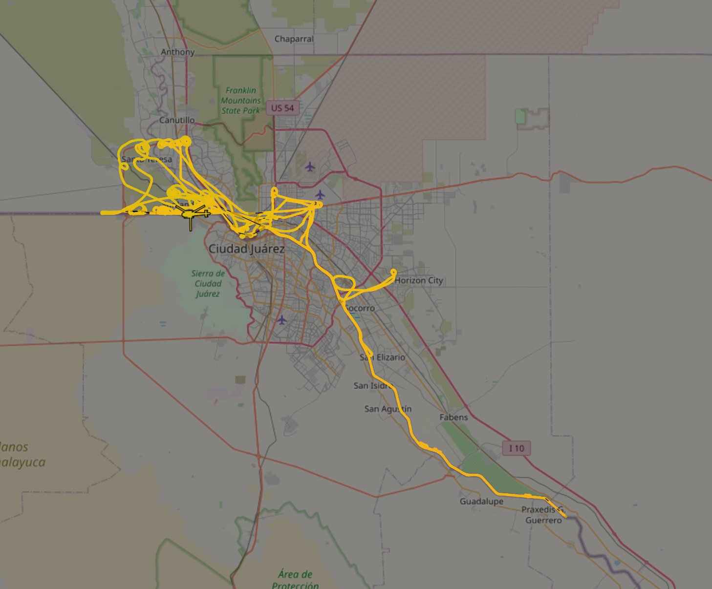
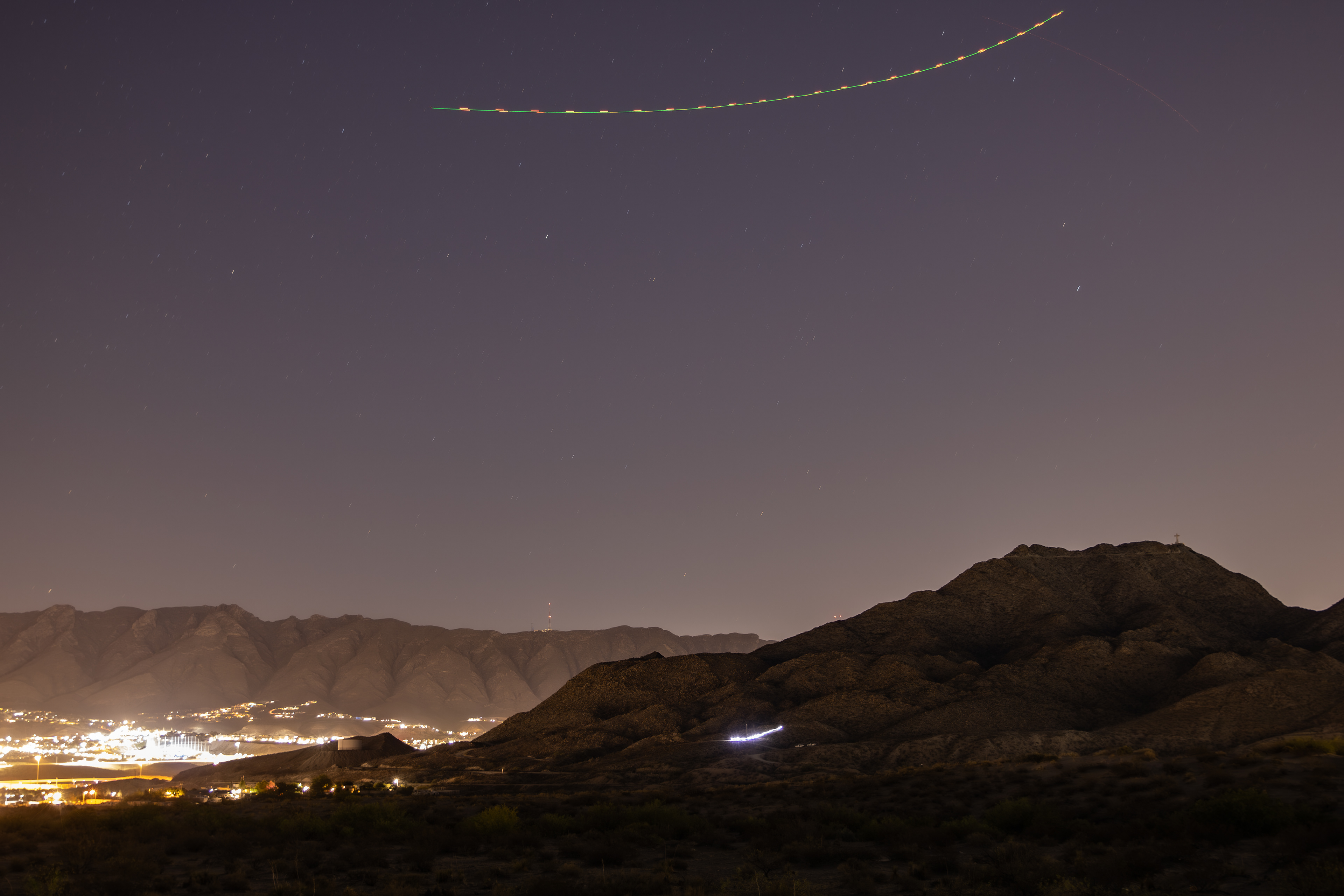
Flight path of Texas DPS Eurocopter AS-350 AStar helicopter (reg N329TX), 25 May 2024 (note: source uses Zulu Time Zone, so this flight path includes my observation and photographs on 24 May). Source: ADS-B Exchange.

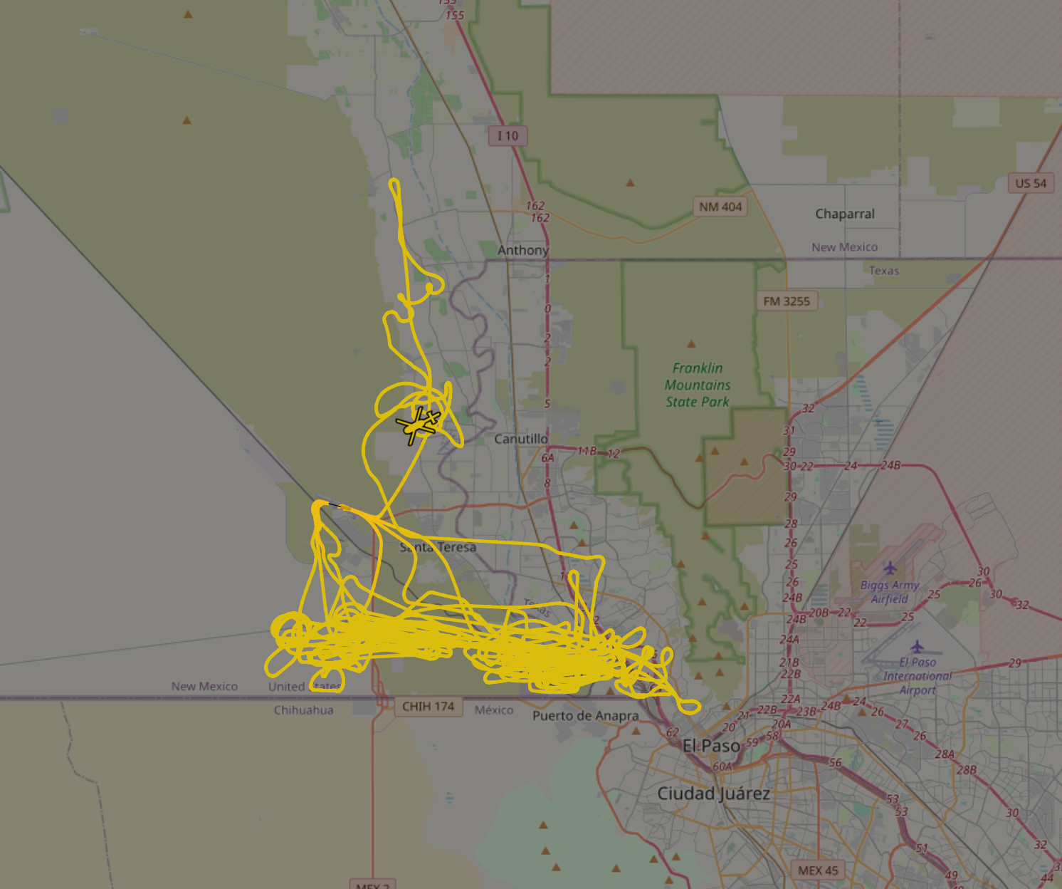
Flight path of U.S. Army Eurocopter UH-72A Lakota helicopter (reg. 12-72270), 25 May 2024 (note: source uses Zulu Time Zone, so this flight path includes my observation and photographs on 24 May). Source: ADS-B Exchange.

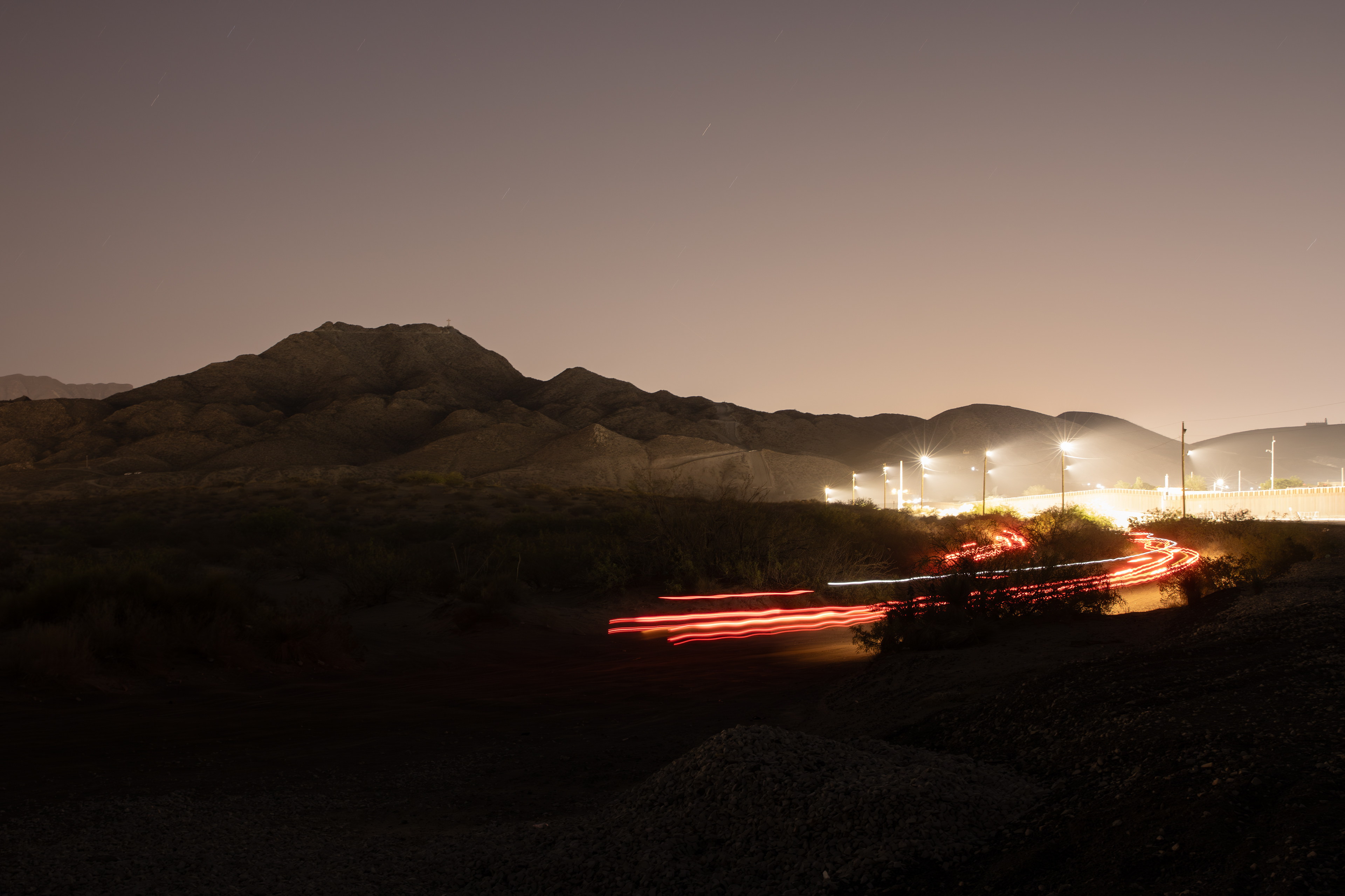
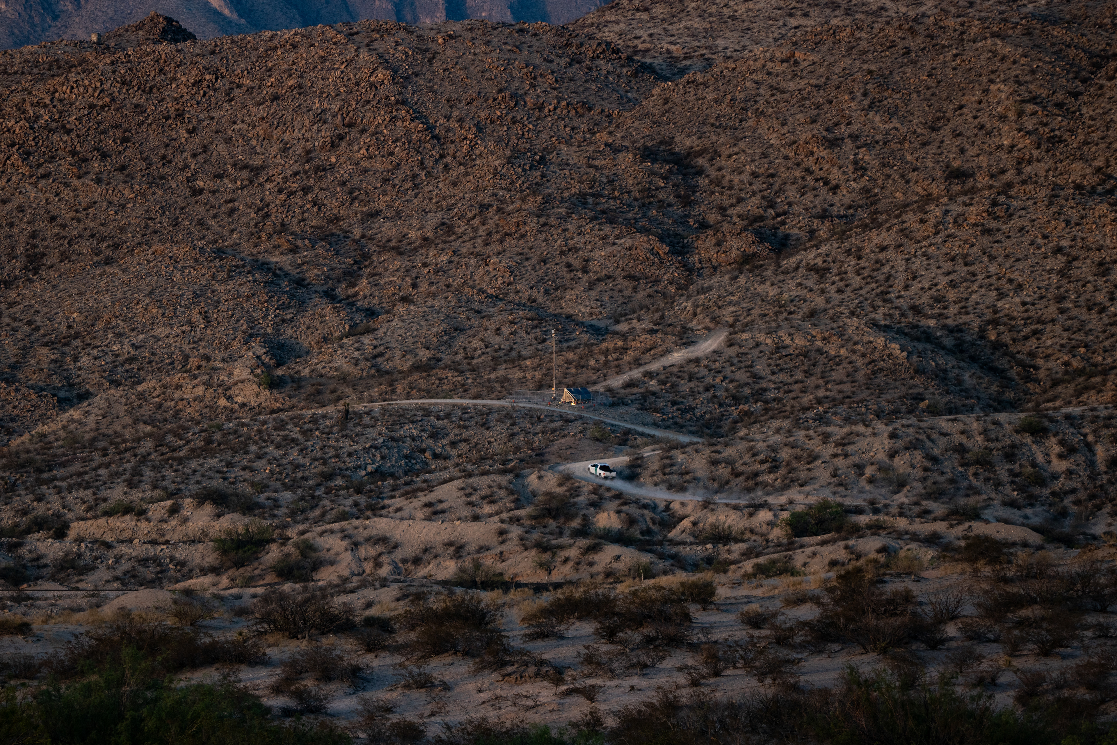
A U.S. Border Patrol truck, possibly alerted to an unauthorized border crossing by one of the surveillance towers or helicopters pictured above—or perhaps by another technology not pictured, such as one of the unattended ground sensors that may or may not lie buried here—speeds along the network of dirt roads that criss-crosses the landscape to the west of Mount Cristo Rey.

Lights from a U.S. Border Patrol vehicle on the western face of Mount Cristo Rey illuminate the "Sentry" Autonomous Surveillance Tower (AST) deployed there (labeled as Site #2 in the Google Earth image above), while a helicopter—either the Texas DPS (N329TX) or U.S. Army (12-72270) helicopter pictured above, or an unknown third helicopter I could hear in the sky at some points but which was operating without an ADS-B broadcast—flies overhead.

Occasionally, the rhythm of patrol shifts, the tempo quickens, and the hunt is on. I described observing one such event in this area of Sunland Park to Lauren Markham, who wrote about it in The Future of the Border Is Even More Dystopian Than You Thought, published in the Sep/Oct 2024 issue of Mother Jones:

"Here [at Mount Cristo Rey], the insistent advance of the border wall is briefly broken by the base of the mountain and becomes a major hotspot for Border Patrol activity, migrant crossings, and deaths. That night, Meyer hung out near the wall in the brush, watching as helicopters patrolled the skies while Border Patrol trucks scoured the dark. At one point, Meyer heard someone climb the wall from the Mexican side and drop down into the United States. Meyer saw the man step carefully over railroad tracks and then disappear into the scrub.

Patrol forces reappeared within minutes, as if something had alerted them to the crossing. Perhaps something had. For the next hour, Meyer watched the hunt. The Border Patrol has access to heat-­seeking cameras, surveillance towers, drones, helicopters, and ground sensors. The man was racing this vast, mechanized force, all odds seemingly against him, and yet every day, in spite of the billions of dollars spent to stop them, people like him manage to get through." 

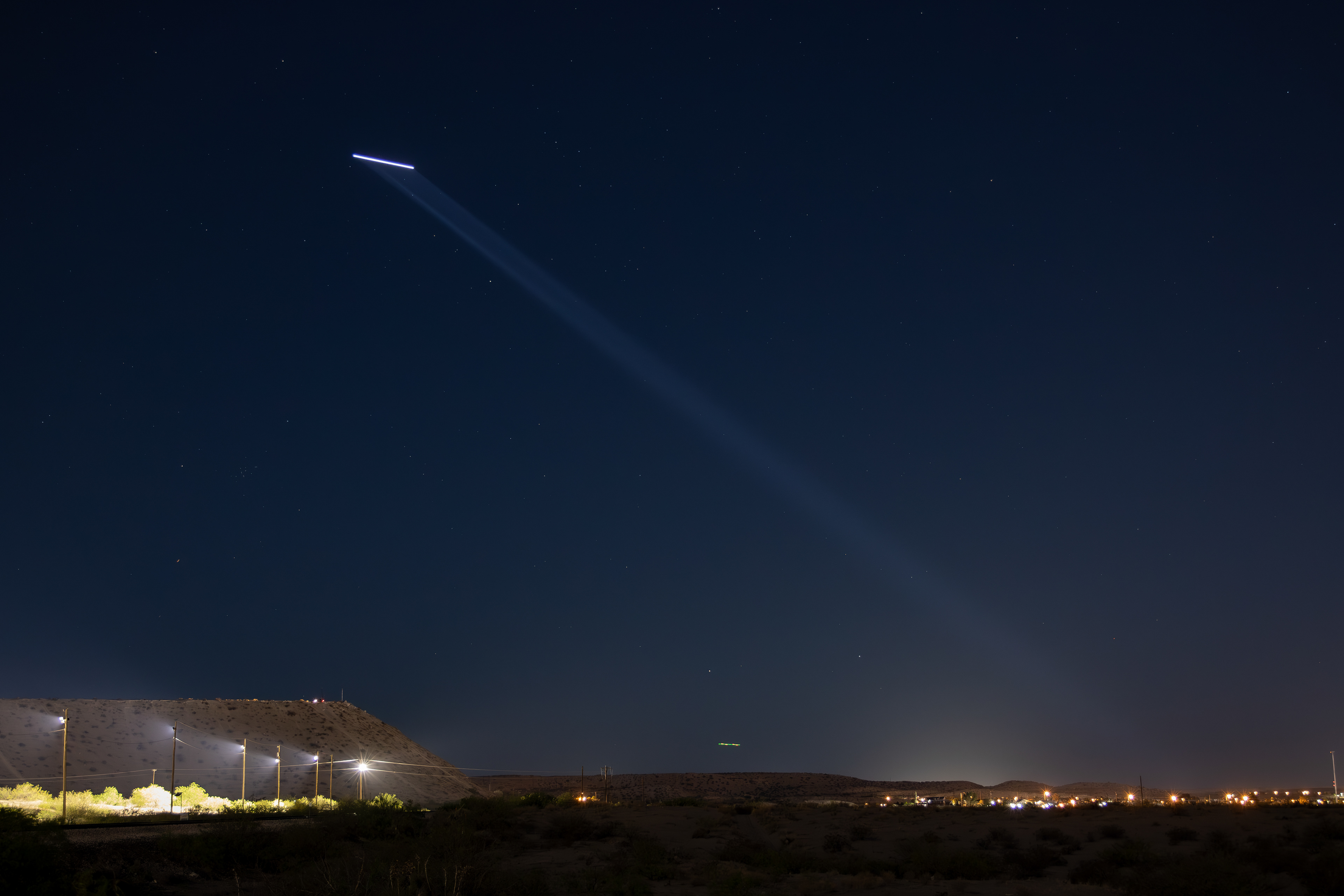
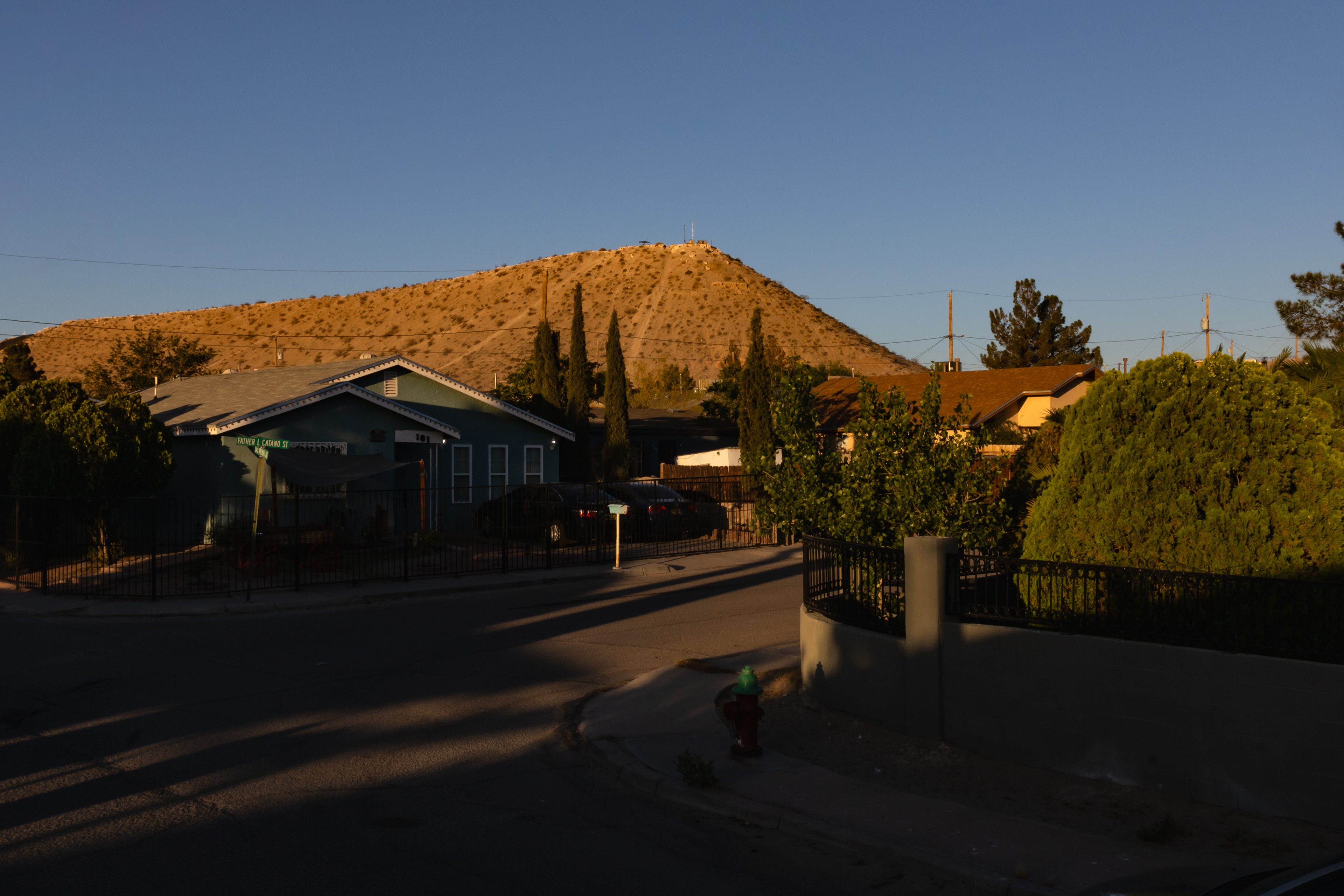
Looking west as the hunt described in the passage above unfolds in Sunland Park. The Autonomous Surveillance Tower (AST), alongside an unidentified type of mobile surveillance tower, located at Site #2 in the Google Earth image above is visible atop the hill to the left. At one point, at least three helicopters were in the sky (the Texas DPS [N329TX] and U.S. Army [12-72270] helicopters pictured above and a third, unidentified helicopter that I could hear but was operating without an ADS-B broadcast). For much of this period, the two helicopters visible here—like the unidentified third mentioned earlier—flew without their operating lights, invisible eyes in the sky suddenly appearing as brilliant beams of light desperately hunting their prey.

The recently released El Paso Sector Migrant Death Database report by the humanitarian group No More Deaths speaks to the human cost of such efforts to 'secure' the border in Sunland Park and elsewhere in CBP's El Paso Sector. In addition to a significant undercounting of migrant deaths in this region by CBP's official figures—in some years the actual number of deaths is two, three, or even four times greater than what CBP reported—the report finds that 15% of all migrant deaths here can be directly attributable to CBP/Border Patrol enforcement actions—resulting from use of force, wall falls, Border Patrol chases, or occurring while in CBP custody. (The report also notes that in some cases, field investigators have stated that they were obstructed from performing a proper investigation or from interviewing Border Patrol agents involved in a death, claims that will not be surprising for anyone familiar with the Border Patrol's long history of covering up such "critical incidents".)

Researchers have long argued that U.S. border enforcement strategy itself—particularly the Border Patrol's so-called "Prevention Through Deterrence" strategy, which was introduced sector-wide in 1994—has been a significant factor in the scale of migrant death suffered in the southwestern border region over the past 30 years, which the Border Patrol puts at roughly 10,000 lives lost but humanitarian groups like No More Deaths and Derechos Humanos have suggested could be as high as 80,000. The Prevention Through Deterrence strategy aims to concentrate surveillance and enforcement in urban areas (like El Paso, where an earlier version was implemented as part of Operation Blockade in 1993), increasing the difficulty and risk of—and thus the supposed deterrent effect against—unauthorized migration by leaving only the more remote and dangerous routes relatively less defended. But rather than decrease the number of migration attempts, the effect of the strategy over the subsequent three decades has largely been to make those attempts more deadly as migrants are pushed further away from developed areas and into harsher environments where thousands—possibly tens of thousands—have died. 

Given this context, the number of deaths that have taken place in relatively populated areas like Sunland Park in recent years has come as a surprise for many. But what the authors of the El Paso Sector Migrant Death Database clearly recognize is that as surveillance technologies and other forms of militarized infrastructure have become an increasingly common feature of even the most remote areas, "an urban area can be essentially as dangerous and deadly as the middle of nowhere."